New Oaxaca–Puerto Escondido Highway: Current Status (November 2026)
New Oaxaca–Puerto Escondido Highway: Current Status and What to Expect in 2026
As of early November 2026, the new Oaxaca–Puerto Escondido highway (the Barranca Larga–Ventanilla toll road) is open in both directions with no long closures reported, but slope-stabilization and maintenance works can bring single-lane passages. Opened on 4 February 2024, it cut a six-hour mountain drive to 2.5 to 3.5 hours. Here is the status stretch by stretch, what happened in 2026, what the tolls cost and how to confirm conditions on the day you leave.
| Route or stretch | Status (Nov 2026) | Time | What to know |
|---|---|---|---|
| Oaxaca – Barranca Larga (Hwy 175, ≈70 km) | Open | ≈1 h | Two lanes, towns and speed bumps; fill up here |
| Barranca Larga – Ventanilla toll highway (104.3 km) | Open, with works | 1–1.5 h | Possible single-lane passages; 2 toll booths |
| Ventanilla – Puerto Escondido (Hwy 200, ≈15 km) | Open | 15–20 min | Easy coastal stretch |
| Free road via San José del Pacífico and Pochutla (175 + 200) | Open | 5–7 h | Endless curves; plan B if the toll road closes |
| Free road via Sola de Vega (Hwy 131) | Open | 6–6.5 h | The classic route; slow and foggy up high |
Status based on public CAPUFE reports and local press up to 9 November 2026. Conditions change within hours with rain, crashes or blockades, so confirm before you leave.

Current Status of the New Highway, Stretch by Stretch
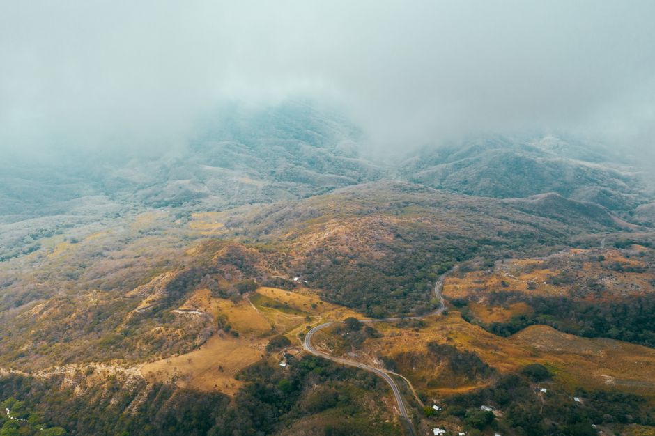
The toll road starts at the Barranca Larga junction, about 70 km south of Oaxaca City, and drops 104.3 km through the Sierra Sur to Ventanilla, in Colotepec, 15 minutes from Puerto Escondido. It is a young road built across unstable slopes, which explains almost everything that happened to it in 2026:
- February: drivers reported potholes and damaged asphalt over several kilometers, and community members near Coatlán threatened blockades over promised works.
- 13 April: the federal transport ministry (SICT) launched cleaning, maintenance and upgrade works worth about MXN 1,216 million.
- July: the road stayed open both ways, with slope stabilization and intermittent single-lane passages.
- September: a three-day community blockade near km 30 (lifted on the 5th) and two crashes that briefly closed km 64 and km 27.
- November: open, no prolonged closures in force; maintenance continues stretch by stretch.

The 2026 Works: What Is Being Fixed and Why
The underlying damage dates from Hurricane John's rains in 2024, which destabilized slopes and drainage on the San Sebastián Coatlán–Ventanilla section, the worst hit. The investment announced in April goes to two fronts, and both can affect your trip:
- Slopes and drainage (≈MXN 716 million): walls, mesh and ditches to stop landslides; this is where single-lane passages with a flagger appear.
- Two new interchanges (≈MXN 500 million): El Limar and San Francisco, so mountain communities can join and leave the highway safely.
- CAPUFE routine maintenance: patching, signage and cleaning along the 104.3 km, with short lane closures, usually in daytime.

Tolls, Drive Times and the Free Roads
There are two toll booths, one at each end of the highway: at CAPUFE's 2026 rates you pay about MXN 245 per booth by car, roughly MXN 490 each way. Carry cash, although cards and TAG are accepted. Door to door, the drive from central Oaxaca takes 2.5 to 3.5 hours, and almost half of that is spent getting out of the Central Valleys. For the kilometer-by-kilometer breakdown, see our guide to how many kilometers it is from Oaxaca to Puerto Escondido.
If the toll road closes, both free roads still work: Highway 175 via San José del Pacífico and Pochutla, and Highway 131 via Sola de Vega. Both are longer, with constant curves and fog up high. Rather not drive? Compare bus, flight and transfer in our guide on how to get from Oaxaca to Puerto Escondido. Before you leave, check the official status with CAPUFE, on 074 or on its social media accounts.

Tips for Driving the Highway Without Surprises
Drive in daylight: the sierra has no lighting and fog rolls in fast in the afternoon. Fill up in the Central Valleys and do not count on services on the toll stretch. Mobile signal is patchy, so download offline maps. In the rainy season (June to October) landslides can close a lane for hours, so never book a same-day flight relying on the ideal drive time. Respect the limits: tight curves and work zones are unforgiving, and most of the 2026 closures were caused by crashes.

Frequently Asked Questions
Is the new Oaxaca–Puerto Escondido highway open?
Yes. As of early November 2026 it is open in both directions with no prolonged closures, though works can reduce traffic to one lane. Confirm on the day with CAPUFE on 074.
How much are the tolls from Oaxaca to Puerto Escondido?
About MXN 490 each way by car in 2026, split between two booths of roughly MXN 245 each.
How long does the new highway take?
2.5 to 3.5 hours from central Oaxaca. The free roads take 5 to 7 hours.
Is the Barranca Larga–Ventanilla highway safe?
It is a modern, busy road, but a mountain one: drive in daylight, respect the limits and check the status before you go, especially in the rainy season.
Rather leave the sierra to someone who drives it every week? Book a private transfer from Oaxaca to Puerto Escondido and arrive straight at the beach.